
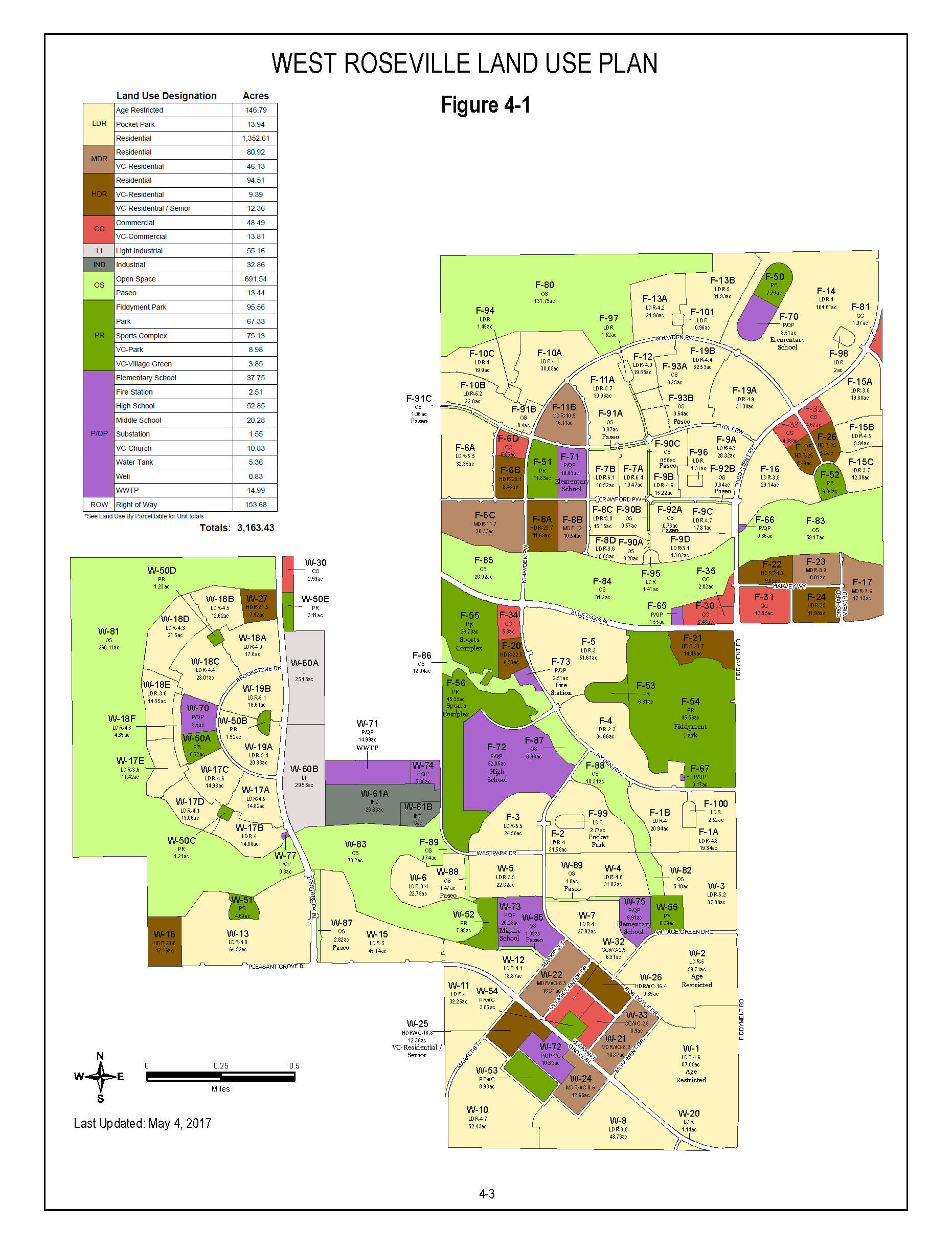
Land use map for the West Roseville Specific Plan (Fiddyment Farm and Westpark) as of May 2017.

By Admin
Land use map for the West Roseville Specific Plan (Fiddyment Farm and Westpark) as of May 2017.
We have placed cookies on your device to help make this website better. You can adjust your cookie settings, otherwise we'll assume you're okay to continue.
Recommended Comments
Join the conversation
You can post now and register later. If you have an account, sign in now to post with your account.